
Photos: NPS Photo · courtesy of National Park Service. Click a photo to enlarge.
Kirby Cove Campground
Overview
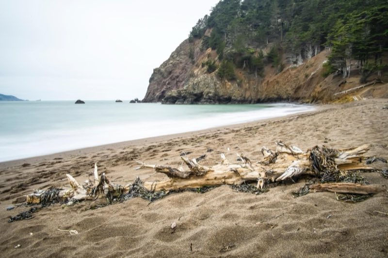
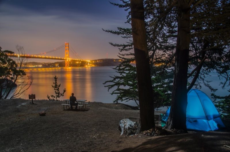
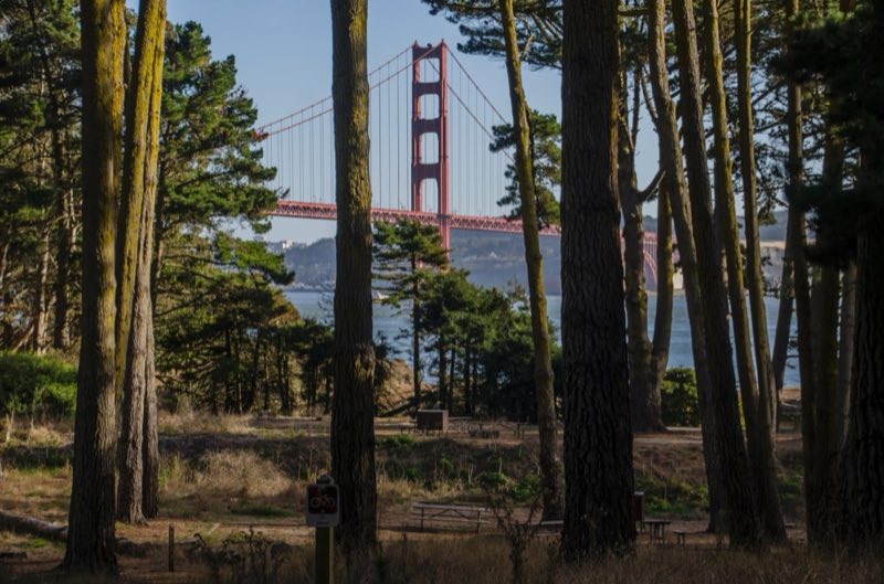
Kirby Cove is the most popular campground in the Marin Headlands, with spectacular views of San Francisco and the Golden Gate. Enjoy a wooded setting, seclusion and protected campsites which were recently restored for all to enjoy.
- Operator
- National Park
- Camping types
- Tent, RV
- Sites
- 6 campsites
- Fee
- From $40 per night (confirm with the operator)
- Reservations
- Reservable online
- Phone
- 415-331-1540
Amenities
Location
Nearby adventures
Hikes and trailheads
- Bay Area Ridge Trail - 01 - North Bay
Please only include routes and waypoints from http://ridgetrail.org See https://wiki.openstreetmap.org/wiki/Bay_Area_Ridge_Trail for more information. OpenStreetMap
Show on map - Bay Area Ridge Trail - 04 - San Francisco and Peninsula
Please only include routes and waypoints from http://ridgetrail.org See https://wiki.openstreetmap.org/wiki/Bay_Area_Ridge_Trail for more information. OpenStreetMap
Show on map - Take a Selfie at Fort Point
Take in the views of the Golden Gate Bridge and San Francisco Bay from below at Fort Point. National Park Service
Show on map - ADT - California - T - Seg 9
California Seg 9: Golden Gate Bridge to Limantour Beach, Point Reyes National Seashore. OpenStreetMap
Show on map - ADT - California - T - Seg 8
California Seg 8: Walnut Creek to Golden Gate Bridge. OpenStreetMap
Show on map - HikANation Historical Route
The original route of the 1980-81 HikANation cross country hike from San Francisco to Cape Henlopen Delaware. OpenStreetMap
Show on map
Mountain biking
- Bike the Golden Gate BridgeShow on map
- Bike to Wildcat Campground
Biking to Wildcat Campground is no easy feat—but a lot of work yields a lot of reward! National Park Service
Show on map - Bike the Bolinas Ridge Trail
Enjoy open, grassy hillsides, redwood forests, decent climbs, and bumpy downhills on this multi-use trail. National Park Service
Show on map - Bike the Bear Valley Trail to the Glen Trail Junction
This wide gravel trail through Douglas fir forest is great for a family cruise, a mellow ride, or the start of a multi-sport adventure! National Park Service
Show on map
Rivers and rafting
- Enjoy the Beach at Aquatic Park Cove
Enjoy the beach and calm water of Aquatic Park Cove. National Park Service
Show on map - Kayak Drakes Estero and Estero de Limantour
Kayaking or canoeing Drakes Estero and Estero de Limantour offers an intimate marine wilderness experience unlike any other. National Park Service
Show on map - Swimming at Point Reyes
What comes to mind when you think about the beach? National Park Service
Show on map
Scenic sights
- Dead Man's Point
Golden Gate Bridge & Downtown Skyscrapers. OpenStreetMap
Show on map - Hawk Hill
Hawk Hill is a 923-foot peak in the Marin Headlands, just north of the Golden Gate Bridge and across the Golden Gate strait from San Francisco, California. Wikipedia
Show on map - Slacker Hill
A peak along California Coastal Trail.
Show on map - Rob Hill
A peak near California Coastal Trail.
Show on map - Rainbow FallsShow on map
Climbing and snow sports
- Cliff House BouldersShow on map
- Main RockShow on map
- Split RockShow on map
Trail and sight data: OpenStreetMap contributors (ODbL) and National Park Service. Text marked Wikipedia is from Wikipedia under CC BY-SA 4.0, lightly shortened.
Reviews
Data sources
Listing details come from the sources above and may be out of date. Confirm fees, dates and closures with the operator before you travel.